Alpine hundred
The idea to go around the Mont Blanc massif around arose when all the climbing plans in the area were completed and there was some free time left. Yes, and the body, tired of the office year, greedily continued to demand a heavy backpack and active body movements.
Having succumbed to the demands of the indefatigable and having acquired a good and detailed map of the area in Chamonix (12 €), it was decided to go on the route.
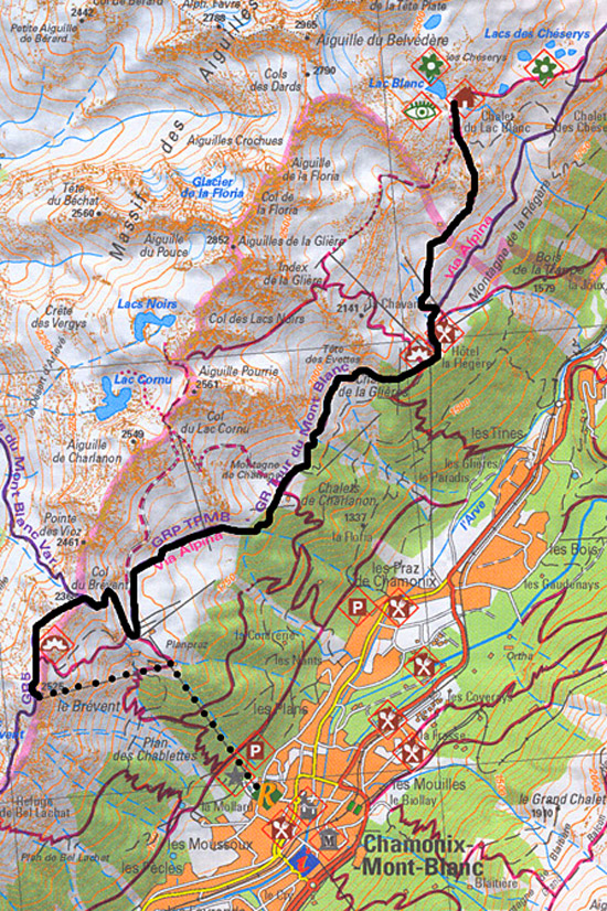
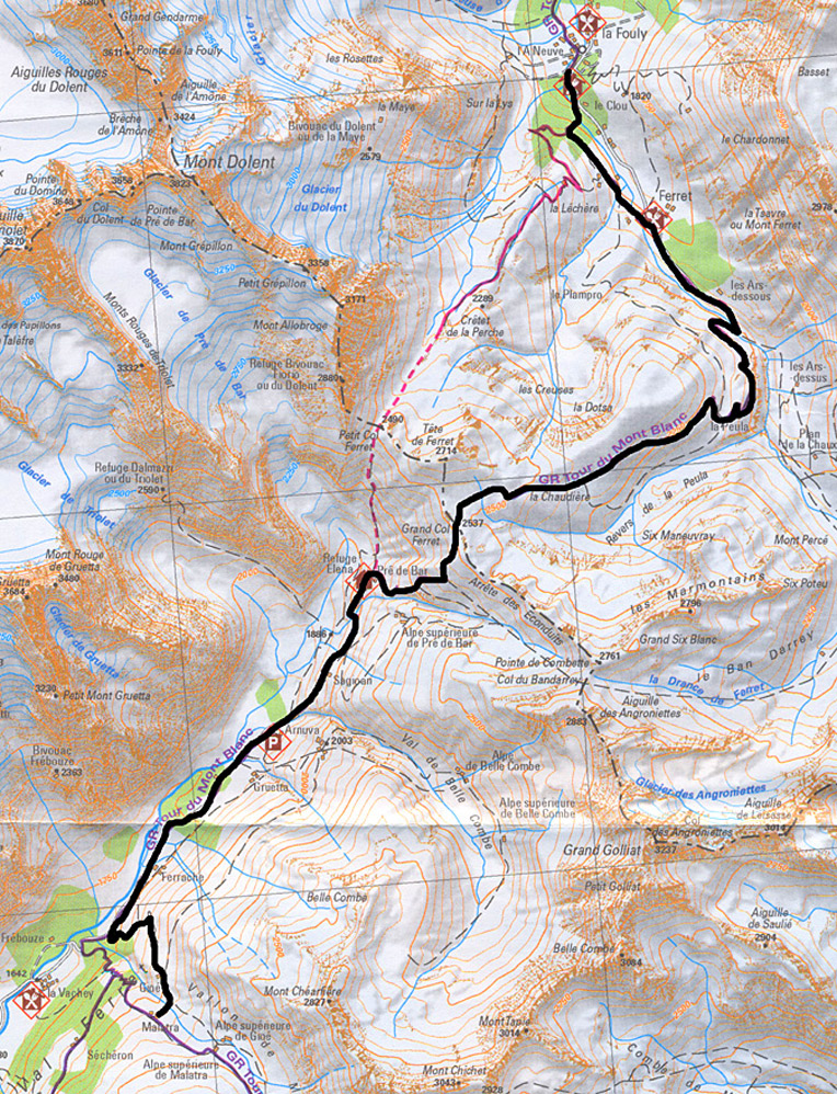
A full circle around Mont Blanc (160 km) takes about 10 days. It is not at all difficult, I would say, in some places even a “free”, beautiful scenic route passing through the territory of three countries: France, Switzerland and Italy. The highest point is 2584 m, there is practically no snow at these heights in the summer months. The climb and drop along the entire route is quite smooth and comfortable.
The best part is that each walking day is not like the previous one - the route is so diverse. He's like a mystery. What awaits me tomorrow?
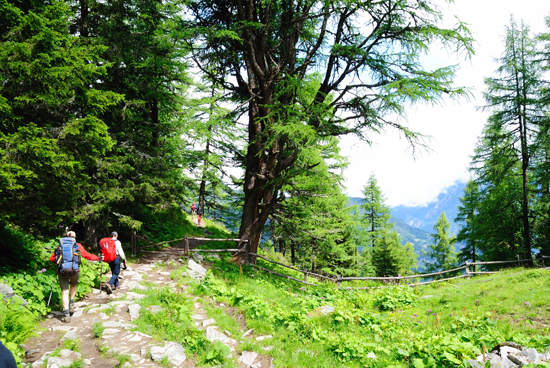
The entire route is well marked. It is impossible to get lost with all the desire. On the marking plates, not only the direction of movement is indicated, but also the average time to go to the point, height.
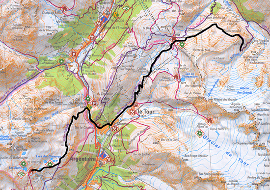
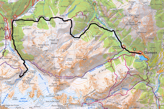
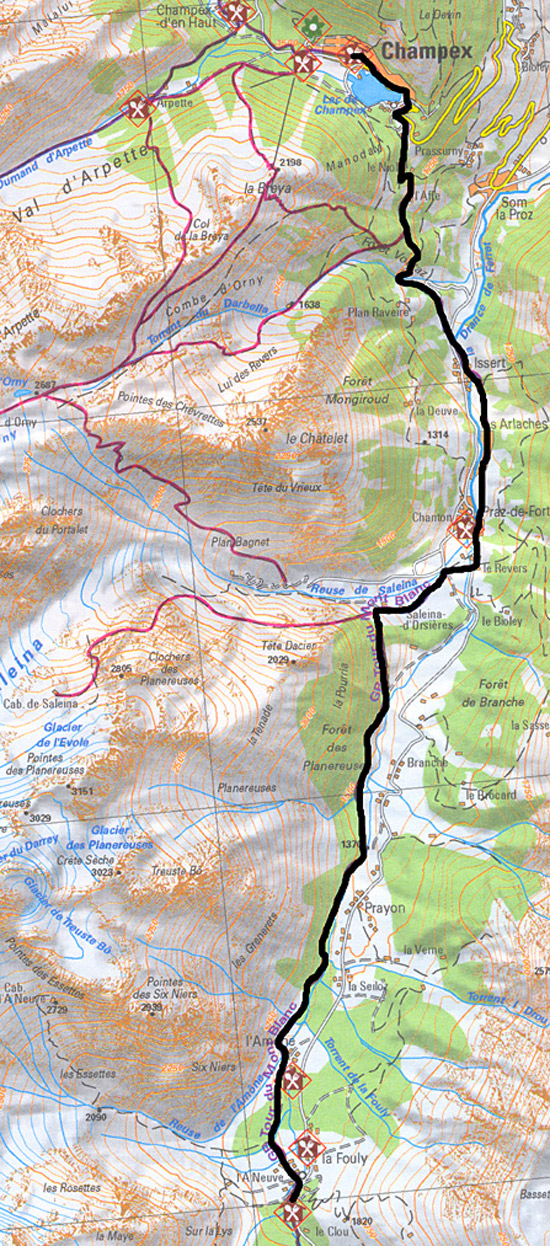
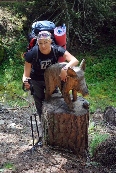
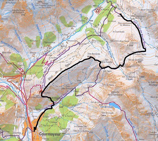
We (due to the lack of free 10 days) decided to limit ourselves to 3/4 parts of this circle, passing the most beautiful part of it from Chamonix to Courmayeur with a return to Chamonix. This is 6 walking days and 100 km of travel.
Day 1. Chamonix - Le Brevent - La Flegere - Lac Blanc, (9 km)
You can go up to the top of the Brevent from Chamonix by cable car (2 lines). We decided to save some money and took advantage of only one line (12 €), walked a little and ended up on the trail of a marked route.
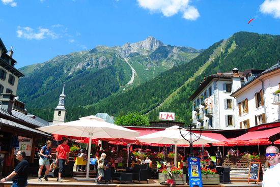
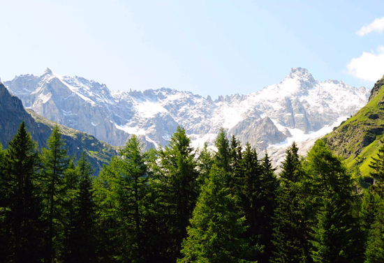
The transition to the La Flegere shelter is practically without climbing along pleasant, flat paths that either run into the forest or lead out into open space. On the right below, as if in ajar hands - Chamonix. And above it is the snow-white Mont Blanc ...
From the shelter "La Flegere" to the alpine lake "Lac Blanc" - today's final point is about 2 hours on foot. The climb is quite steep, but beautiful and not tiring.
Yes, a little clarification. It is not allowed to spend the night in tents on unequipped places along the route. It is proposed to spend the night either in mountain shelters or in tents set up in specially designated places (naturally for money).
But it’s not that we don’t have money, but rather there is a huge Ukrainian “Toad”, which quietly whispers to us: “Well, here it is, a cozy clearing near a small lake, perfectly sheltered from prying eyes by rocks, well, who will drive you out of here late in the evening … Why do you need this shelter for 30 €???”
Having succumbed to the persuasion of the nasty "Toad", we stop for the night in the wrong place, at that very cozy lake.
View of Mount Brevent. Our journey began from the top
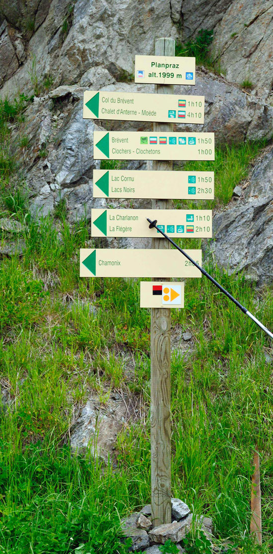
So wonderfully conveniently marked routes in the mountains
View of Chamonix
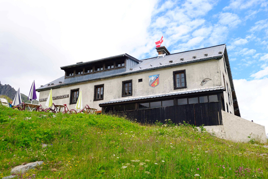
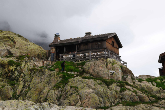
Shelter "La Flegere"
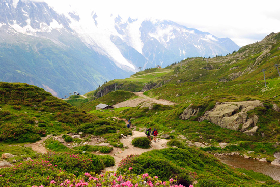
Start of the trail on Lac Blanc
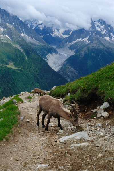
Goats
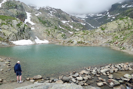
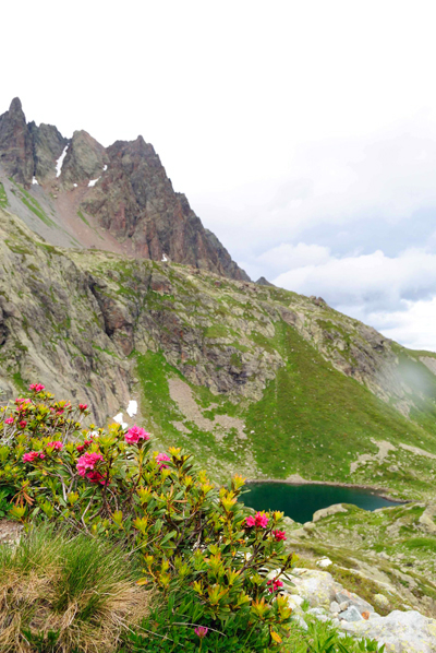
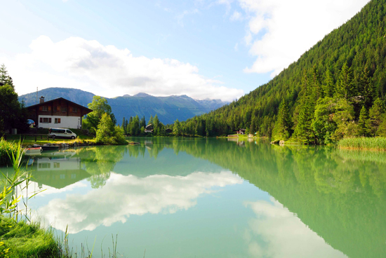
«Lac Blanc»
Somewhere near such a lake we spent the night
Day 2. Lac Blanc - Col Montets - Tre-le-Champ - Le Tour - Col de Balme - Les Grands, 15 km
The first half of this day’s journey is the descent from the lakes to the track (Tre-le-Champ) and the village of Le Tour, where at the cable car station in a small cozy cafe you can have a bite to eat and drink a cup of tea, coffee or ... beer!
From Le Tour begins not a steep but long climb to the Col de Balme pass. Information for the lazy: for just some 12 € you can ride the cable car to Col de Balme.
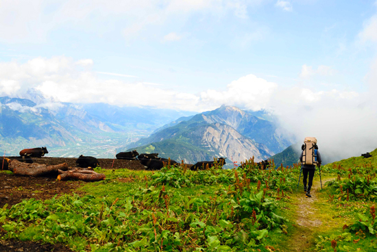
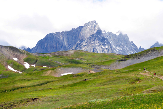
The pass offers probably the most beautiful view of Mont Blanc, which I managed to contemplate during my stay in this area. From no point does it look so majestic and welcoming at the same time.
Beyond the pass is Swiss territory. Here we deviated a little from the classic route that suggests spending the night on Les Grands and went down to the lower overnight stays of Le Peuty, where for only 3 € per person we managed to set up tents on a sunny meadow (firewood, drinking water, toilet) and dry things after the day bad weather.
This parking lot can be seen on a piece of the map of the 3rd day.
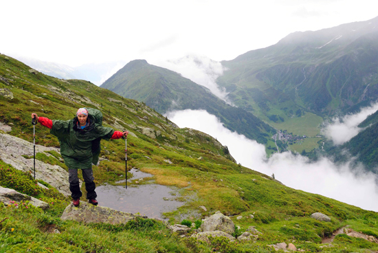
Wind… On the descent from the lakes
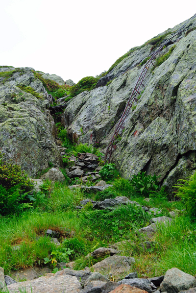
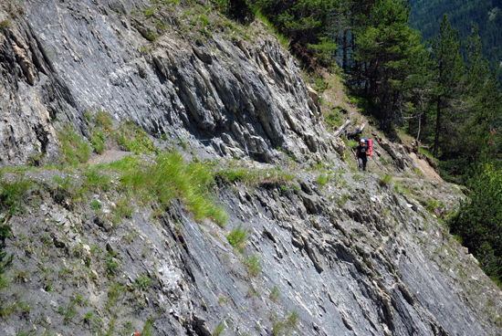
Via Ferrata. This is how steep sections of descents are equipped
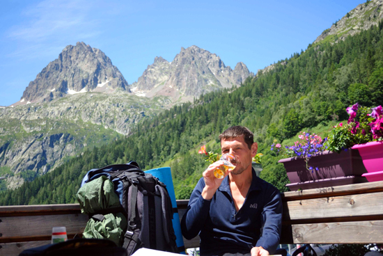
A beer at Le Tour before a long climb was very welcome
Oh what was BEER!!! Do you want to taste? Then you are here - Trekking around Mont Blanc
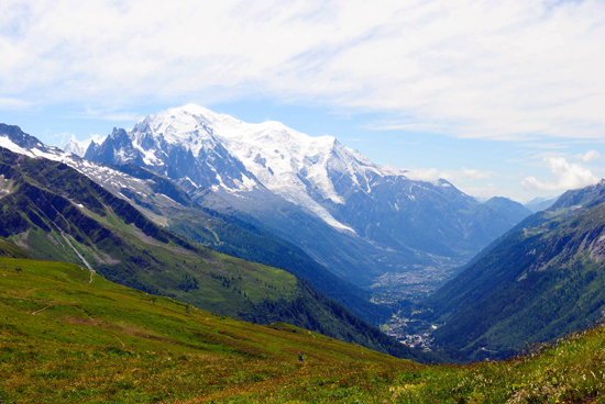
View of Mont Blanc and Chamonix from the Col de Balme
Downhill trail from the Col de Balme pass
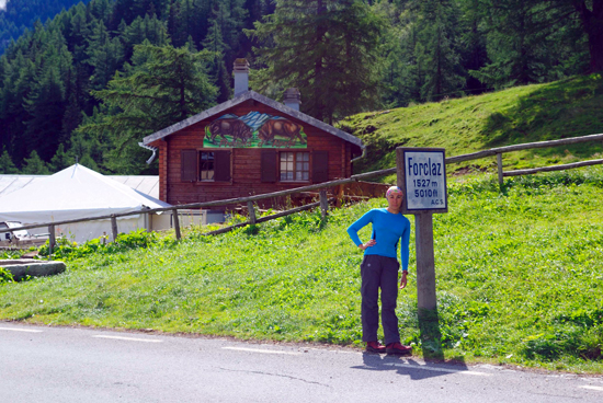
Day 3. Les Grands - La Forclaz - Bovine - Champex, (18 km)
The day began with an ascent to the low pass La Forclaz and then ascent to the Bovine shelter. The transition to Bovine somehow subtly reminded me of the Carpathians, somewhere in the middle of the ascent to Nesamovyty. The same heights (well, maybe a little higher), the same vegetation, similar trails... Or maybe it's nostalgia?
From Bovine - a wonderfully cozy haven where everyone usually stops for lunch - descend to Champex, a small Swiss highland town.
You can stay overnight in a tent camping (7 € per person). We, again listening to the voice of "Toad", spent the night a little before reaching the town in the forest on the banks of a mountain river. Very cozy and romantic.
La Forclaz Pass
Nearly the Carpathians
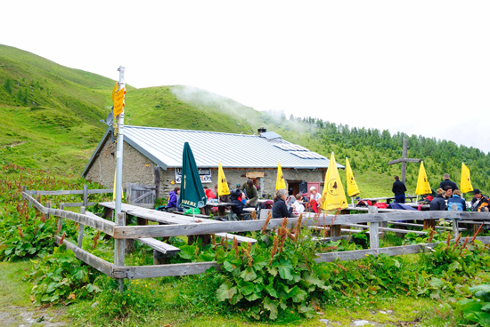
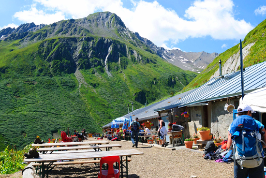
Shelter Bovine
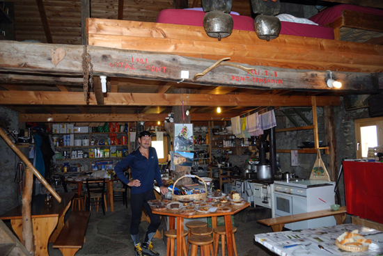
In the shelter you can not only eat, but also spend the night if necessary.
Beginning of the descent from Bovine
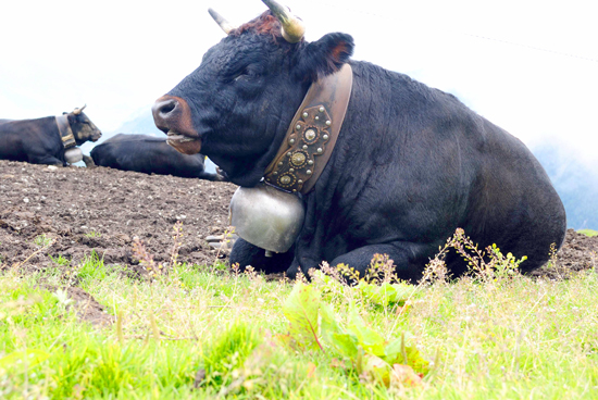
Bell fitness for swiss cows
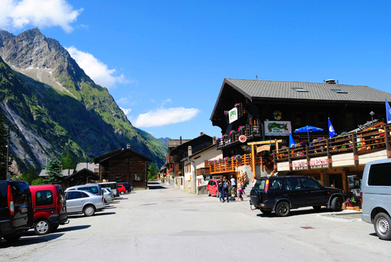
Day 4. Champex – Issert – La Fouly, (14 km)
I would call this day a day of freebies and rest. The transition without climbing, through beautiful places, began in the town of Champex, which stands on the lake of the same name.
At Champex, the crazy aroma of coffee and fresh pastries lingers for a while. I'm going for the smell. We arrive at a small cozy cafe on the shore of the lake. Coffee break…
By the way, in the city you can replenish food supplies, and on a weekday you can buy gas if necessary. If there is no urgent need to replenish food, it is better to postpone shopping until you arrive at La Fouly. There the store is much cheaper and the range is bigger.
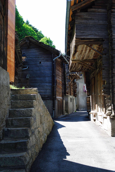
Then the road through several small, picturesque Swiss villages, forests and fields leads to the village of La Fouly.
There is a huge expensive campsite in the clearing. Negotiations with our "Toad" were cut short at the very beginning. On the 4th day of the journey, I wanted a hot shower, laundry and the Internet.
Although ... if you go a little further, about 15 minutes towards the village of Ferret, there are such chic overnight stays, by the river ...
Lac de Champex
On the forest path that starts from Champex, the creativity of Swiss foresters delighted and amused
Issert village street
On the trail
Mountain view from the campsite at La Fouly
The village of La Fouly is one long street
Day 5. La Fouly - Grand Col Ferret - Rifugio Elena - Rifugio Bonatti, (8 km)
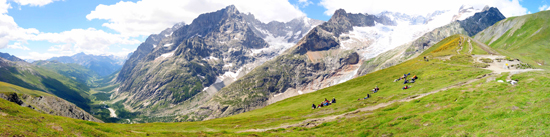
This is the wow day! Firstly, the beauty is unreal, and secondly, the freebie has finally ended and normal walking has begun - a decent gain and drop in altitude per day and mileage is good. On this day, I was even tired.
From La Fouly, through the village of Ferret, the ascent to the Grand Col Ferret pass begins. The rise of a long, but not steep 1000 m of height, which you need to gain, was not particularly strained.
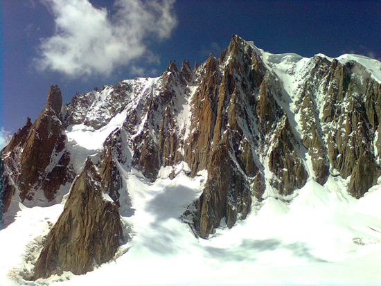
On the pass - a prize to the climber! Stunning views of the valley, all the main peaks of the massif. From here you can even see the other side of the Matterhorn and Monte Rosa.
Beyond the pass is Italy. Quite a steep descent to Elena's hut and then a transition to the Bonatti shelter. On the right is the Italian side of Mont Blanc.
By the way, having gone down from Elena's shelter to the highway, you can, if necessary, take a bus to Courmayer. The bus runs approximately once an hour and costs 2€.
On the way to the pass another restaurant
The path to the pass. Its final flat section
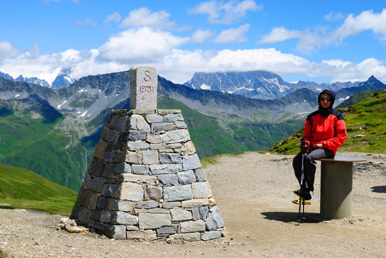
Grand Col Ferret Pass
View from the pass. Sit down and don't get up. Awesome beautiful!!!
Choose a tour - Trekking around Mont Blanc, It will be an unforgettable experience for a lifetime!!!
Day 6. Rifugio Bonatti – Tête de la Tronche – Courmayeur, (16 km)
The last day - also not at all free - a transition with a descent into the Italian Courmayer.
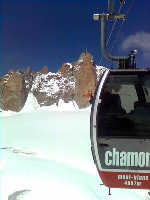
Those who have not taken the cable car to the Aiguille du Midi (3842 m) from Chamonix will probably be interested in taking the cable car from Courmayère to Chamonix - to see the entire massif and the plateau from above, to get to the observation platform 3800. This option is much more expensive than the bus (about 60€ per person) but it's worth it.
We were already on the Midi and trampled these snows with our feet, so we took the bus (20 €) and after driving under the famous tunnel under Mont Blanc in an hour we were in Chamonix.
Cable car from Courmayeur
View of the mountains and plateau from the cable car
Arriving in Chamonix, we got into the car and drove the rest of the route from the West side from Chamonix to Courmayeur. Yes, this is not a trail, but the road offers amazing views and very interesting places.
And then there was the sea… the Mediterranean…, the sea of wine, the sea of romance….
But that's a completely different story...
Are you still thinking about going trekking or not? See more information - Trekking around Mont Blanc
- More of our programs in France - look
If you liked the article, put Like and share with your friends!